
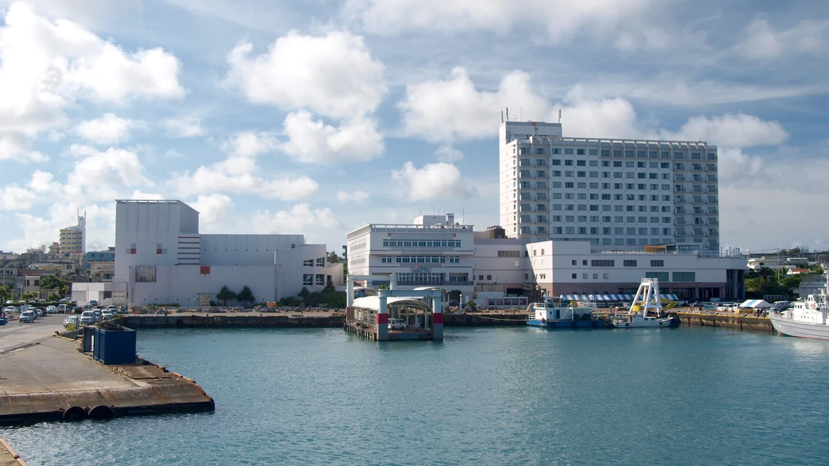
Miyakojima cruise port uses Hirara as the gateway to an island defined by pale beaches, coral water and long bridges rather than a concentrated city centre. The port itself is close to urban services, but the views passengers have travelled to see are spread around the island.
The strongest plan is a controlled half-day circuit, not an attempt to visit every bridge and beach. A driver, ship excursion or well-researched vehicle booking gives far more flexibility than waiting for scarce taxis after several ships or tour groups arrive.
Miyakojima Cruise Port at a Glance
| Port name | Miyakojima Cruise Port (Hirara) |
|---|---|
| Main arrival area | Hirara Port on the north-western side of Miyako Island |
| Cruise region | Asia |
| Country / Territory | Japan |
| Currency | Japanese yen (JPY) |
| Languages | Japanese; some English is used by tourism and port staff |
| Port role | Island day-call port for beaches, coral water, coastal viewpoints and bridge-linked islands |
| Disembarkation | Normally docked at Hirara Port cruise facilities; a shuttle or controlled port transfer may connect the berth with central Hirara |
| Walkability | Low from the cruise berth to the island’s main attractions; moderate within central Hirara |
| Shuttle required | A port or cruise-line shuttle may operate, but its route and final departure must be checked on the day |
| Main transport | Ship excursions, taxis, pre-booked drivers, local buses, rental vehicles and marine tours |
| Best first-time plan | Use a pre-arranged driver for Yonaha Maehama, one major bridge viewpoint and a relaxed lunch |
| Main caution | The island looks compact, but attractions are dispersed and taxi or bus availability can limit the return |
Weather & Best Time to Visit Miyakojima
Miyakojima is warm for much of the year, with a short mild winter and a long humid season. Spring and late autumn are often comfortable for island touring, while summer brings intense sun, warm water and the greatest risk of typhoon disruption. Check the current forecast and any JMA warning before the call. Strong wind, heavy rain, high ultraviolet levels or a tropical cyclone can close beaches and marine activities even when the ship reaches Hirara.
| Month / season | Typical high | Typical low | Rain / conditions |
|---|---|---|---|
| December–February | 22°C | 17°C | Mild, breezy and sometimes cloudy; sea conditions can feel cool |
| March–May | 27°C | 21°C | Warmer with increasing humidity and periods of rain |
| June–September | 31°C | 26°C | Hot, very humid and exposed to typhoons, heavy showers and strong UV |
| October–November | 27°C | 22°C | Warm with gradually lower humidity; storms remain possible early in the period |
Winter
A beach can still be scenic, but swimming comfort depends on wind and the day’s water temperature. Carry a light layer for an exposed viewpoint or boat.
Spring
This is a strong period for a land circuit. Rain can arrive quickly, so keep the beach and bridge order flexible.
Summer
Plan shade, water and shorter outdoor stops. Follow beach safety notices and do not enter the sea when local staff close an area.
Autumn
Conditions often improve after the peak heat, but a late tropical system can still affect the port and flights. Check warnings close to the call.
Arriving at Hirara Port
The national Cruise Port Guide of Japan identifies Hirara Port on the north-western side of Miyako Island. The working harbour includes cruise facilities, but the walking route from the actual berth to central Hirara can vary with security and ship size.
Follow the ship’s instructions on shuttle buses and pickup points. A shuttle may finish in central Hirara rather than at the gangway, which means the return requires both the town departure and the final port transfer. Photograph the stop and the last-bus time before leaving.
Passengers using a private operator should send the berth or shuttle-stop details before the day. “Miyakojima port” is too broad because local ferries, fishing areas and the cruise berth occupy different parts of the harbour.
How to Get Around Miyakojima
Taxis are the simplest option for a small group, but supply can tighten when a large ship arrives. Reserve in advance where possible and agree whether the fare is metered, hourly or fixed for a circuit. Ask the driver to repeat the final port or shuttle location.
The official guide to buses on the Miyako Islands explains the local network, but public buses are designed for residents rather than a cruise-day sightseeing loop. They can work for a simple journey, not for a chain of beaches with a tight gangway deadline.
Rental cars offer independence but require an international driving permit where applicable, advance availability and confidence with Japanese road rules. Collecting and returning a vehicle can use a surprising amount of a short call, so compare the real door-to-door time with a driver.
Yonaha Maehama Beach
Yonaha Maehama is the classic first-time beach: a broad stretch of pale sand facing Kurima Island. It works well as the anchor for a port day because the journey from Hirara is manageable and the beach gives enough space for swimming, walking or simply seeing the colour of the water.
Facilities and seasonal services should be checked rather than assumed. Carry a towel, sun protection and water, and use designated swimming areas. Coral islands can have currents and marine hazards even when the sea looks calm from the road.
Pair Maehama with Kurima Bridge or one nearby viewpoint. Adding the northern bridges and Cape Higashi-Hennazaki turns a relaxed beach visit into a full island circuit and removes the return buffer.
Sunayama Beach and Beaches Near Hirara
Sunayama lies closer to Hirara and is visually dramatic, with a short approach over a sandy rise. The gradient and loose surface make it less suitable for some passengers than the distance on a map suggests.
Beach access, erosion controls and swimming advice can change. Respect barriers and do not climb on fragile rock formations for a photograph. The island’s beauty depends on visitors treating coral, dunes and vegetation as protected landscape rather than props.
A closer beach is useful on a short call, but it should not be sold as effortless. Confirm the path, shade and taxi collection point before leaving the vehicle.
Irabu Bridge and the Western Islands
Irabu Bridge provides one of Miyakojima’s defining road views, crossing vivid water towards Irabu Island. The bridge itself is a transport link rather than a place to stop wherever the view is best; use authorised viewpoints and allow the driver to concentrate on the road.
An Irabu circuit can include coastal scenery, a beach or a local lunch. It should replace, not accompany, a complete east-island tour. Distances remain modest by mainland standards, but repeated stops, narrow roads and parking consume time.
When wind is strong, exposed bridges and headlands can feel very different from sheltered Hirara. A tour operator may alter the order or remove a marine stop, which is preferable to forcing an unsafe itinerary.
Ikema Bridge, Kurima Bridge and Cape Higashi-Hennazaki
Ikema Bridge leads north towards another wide coral-water panorama. It combines logically with northern viewpoints but not with every western beach. Choose it when a scenic drive is more important than extended swimming.
Kurima Bridge sits close to Yonaha Maehama and is the easiest bridge to add to a beach-centred plan. The pairing keeps the route compact and leaves time for lunch or central Hirara.
Cape Higashi-Hennazaki occupies the eastern tip and gives a windswept contrast to the resort beaches. It requires a longer cross-island drive and exposed walking. Use it as the main landscape stop on an east-island itinerary rather than a final extra.
Snorkelling, Diving and Marine Safety
The official Miyako Island destination guide highlights coral water and marine activities, but the safest experience uses a recognised operator who supplies equipment, checks conditions and understands the cruise return.
Snorkelling from an unstaffed beach is not a suitable fallback when a booked tour is cancelled. Currents, coral cuts, jellyfish and sudden weather changes require local judgement. Wear a flotation aid when advised and never stand on coral.
Divers must confirm certification, equipment, depth and surface intervals. A cruise day is not the place to squeeze a technical or multi-dive programme into an uncertain port window. Keep the operator’s vehicle and boat plan tied to the ship deadline.
Central Hirara, Food and Shopping
Central Hirara offers restaurants, convenience stores, small shops and a less hurried alternative to an island circuit. It is useful at the beginning or end of the day, particularly when a shuttle connects the port with town.
Miyako soba, local tuna, tropical fruit and awamori provide a clear sense of place. Check whether a restaurant accepts cards and whether the group can be served within the available time. A popular lunch queue should not threaten the last shuttle.
Textiles, salt, sweets and packaged local products are easier ship purchases than fresh agricultural items. Keep receipts and follow customs rules on food. Japan is card-friendly in many places, but cash remains useful for smaller businesses and buses.
Mobility and Accessible Planning
The cruise berth and coaches may be accessible, yet beaches often involve sand, steps or uneven paths. Ask for the exact distance from vehicle to viewpoint and whether an accessible toilet is available at the stop.
A scenic bridge circuit can provide a strong day for passengers who cannot manage sand. Select viewpoints with paved access and use central Hirara for lunch. The island’s water colour can be enjoyed without forcing a beach transfer.
Heat is a mobility issue as well as a comfort issue. Use air-conditioned vehicle time between short outdoor stops, carry water and avoid scheduling exposed headlands in the middle of a summer day.
Miyakojima Cruise Port Timing
Begin with the farthest priority and move back towards Hirara. A western beach and Kurima circuit should return towards town before lunch; an eastern cape route should turn west with a generous reserve. This prevents the final hour from being spent on the opposite side of the island.
Ask the driver to identify one stop that will be removed if traffic, parking or weather causes delay. A pre-agreed release point is easier than debating the itinerary when the last shuttle is approaching.
Passengers relying on a shuttle must reach the town stop before its final departure, not merely the port before all-aboard. Keep the schedule card offline and allow for security after the shuttle arrives at the berth.
CruisePing Recommended Miyakojima Port Day
Pre-book a taxi or small tour and travel first to Yonaha Maehama. Add Kurima Bridge, one viewpoint and a local lunch, then return through central Hirara with time to spare.
Passengers who prefer a scenic drive can replace beach time with Irabu Bridge and selected western-island viewpoints. Do not attempt Irabu, Ikema, Kurima and the eastern cape in one ordinary call.
If marine weather is poor, use a bridge-and-culture circuit rather than searching for an unofficial beach that appears sheltered. The successful day is the one that adapts early.
Common Miyakojima Cruise Port Mistakes
- Waiting until arrival to find a taxi for a full island tour.
- Assuming every beach has lifeguards, lockers and reliable shade.
- Trying to collect all three major bridges in one short call.
- Using public buses for a complex multi-stop itinerary.
- Entering the sea after local warnings close a beach.
- Forgetting that the last shuttle from town may be earlier than all-aboard.
- Underestimating sand, heat and exposed headland walking.
- Booking a marine activity without a clear port return.
Building a Sensible Miyakojima Island Loop
Miyakojima’s bridges make a circular sightseeing route tempting, but each island connection adds road time and another point where the group can be delayed. A first visit works best with one bridge landscape, one beach or marine stop and lunch, not a checklist of every connected island.
Irabu Bridge pairs naturally with western or northern scenery. Kurima Bridge suits a southern-beach route, while Ikema belongs to the north. Choose one direction and continue through it rather than repeatedly returning across Hirara.
The city’s digital visitor map helps passengers see the scale before booking. Ask the driver to mark the final attraction and estimated return to Hirara, then remove the least important stop if the first beach or viewpoint takes longer than planned.
Cruise-Day Taxi Supply
Taxi availability can tighten sharply when a large ship arrives. A vehicle found easily in central Hirara may not be available later at a remote beach, and app coverage does not guarantee that a driver is nearby.
Pre-book a half-day or full-day vehicle for a multi-stop route. Agree the total hours, waiting, parking and whether the driver speaks enough English for changes. Save the vehicle plate and write the cruise berth in Japanese.
For one simple destination, ask the outbound driver to wait or arrange a return. A beach without a taxi rank is not a safe final stop when the ship deadline is fixed.
Snorkelling and Beach Safety
Clear water does not remove current, coral or marine-life risk. Use a managed beach or recognised operator, check whether lifeguards are present and follow seasonal warnings. Reef entry can be sharp and slippery even when the sea looks calm.
Do not stand on coral or chase turtles. Strong swimmers can still be carried away from a reef edge, while inexperienced passengers may struggle to re-enter over rock. A guided snorkel is the better choice when the site is unfamiliar.
Keep dry clothes and the ship card protected from sand and spray. Build changing time into the route; leaving a beach at the last minute while wet and without transport arranged is a common way to lose the port margin.
Hirara for a Short or Weather-Affected Call
When the call is shortened, remain around Hirara and one nearby coast or bridge viewpoint. The city provides restaurants, shops and ordinary island life without committing to a full road circuit.
Wind can cancel marine activities while roads remain open. In that case, use the bridge as a scenic drive, add a museum or craft stop and choose a local lunch. A land route should be selected in advance rather than negotiated after the boat operator cancels.
Finish near the shuttle or berth. The most reliable final hour is not at an isolated cape but in the town where another taxi or ship bus remains possible.
Local Courtesy and Protected Places
Miyakojima’s beaches and sacred places are not simply cruise attractions. Follow signs, stay out of closed areas, avoid entering private tracks and do not photograph worship or residents without permission.
Carry rubbish back to the vehicle when bins are unavailable. Use reef-safe practices, avoid removing shells or coral and follow parking instructions at small coastal sites where a cruise-day surge can overwhelm local roads.
A quieter itinerary often creates a better encounter with the island than a fast loop. Time at one beach, viewpoint or café is more valuable than collecting bridge photographs from a moving vehicle.
Miyakojima Cruise Port Checklist
- Confirm the Hirara berth and shuttle.
- Reserve a driver or tour before arrival.
- Choose one part of the island.
- Check beach and marine warnings.
- Carry yen, water and sun protection.
- Save Japanese place names offline.
- Identify the final town shuttle.
- Use paved viewpoints when mobility is limited.
- Keep a weather-proof land alternative.
Useful Official Links
Use these official pages for the port, island transport, destination planning, digital maps and current weather warnings.
- Hirara Port: Cruise Port Guide of Japan
- Official Okinawa guide to Miyako Island
- Official guide to buses on the Miyako Islands
- Miyakojima City digital tourist map
- Japan Meteorological Agency forecast
Miyakojima Cruise Port FAQ
Where do cruise ships dock on Miyakojima?
They normally use cruise facilities at Hirara Port. The ship may provide a shuttle or controlled transfer from the berth.
Can I walk from the port to the beaches?
No practical first-time beach is reached by a simple walk from the cruise berth. Use a taxi, tour or planned vehicle.
Can public buses cover the island?
They serve local routes but are not designed as a frequent cruise sightseeing circuit. Use them only for a simple, verified journey.
Which beach is best for a first visit?
Yonaha Maehama is the clearest all-round choice when conditions suit.
Do I need Japanese yen?
Yes. Cards are common, but cash is useful for buses and smaller businesses.
Is Miyakojima accessible?
A vehicle-based scenic tour can work well, but many beaches and viewpoints include sand, gradients or uneven surfaces.
CruisePing Port Verdict
Miyakojima cruise port rewards restraint. Its colour and space are best experienced through one coherent part of the island, not a hurried lap of every bridge and cape.
CruisePing would pre-book a driver, pair Yonaha Maehama with Kurima and finish in Hirara. That route shows the island’s defining water while keeping the return simple.
Ready to browse our article library?
Looking beyond Miyakojima? Explore more ports in the Asia region, or narrow it to Japan in particular. For cruise comparisons, planning shortcuts and value guides, head over to our main article archive.